 |
| Foggy morning. |
 |
| This is the ferry we took. |
 |
| Heading into Newfoundland. |
 |
| Cornerbrook, Newfoundland. We were on our way to Gros Morne. |
We stayed at a KOA campground that just happened to be right in the centre of the National Park.
 |
 |
 |
| I took this picture from a hill just beyond our campsite. You can see Lindsay standing in front of our campsite, and mountains off in the distance. |
From our campground we could see the mountain which is also named Gros Morne. It is the second largest mountain in Newfoundland, being over 800 m high. Gros Morne stands for ‘big lonely mountain’. Since the mountain is so high, it has an arctic climate and is home to animals that wouldn’t normally live in Newfoundland. On the mountain lives arctic hare and also rock ptarmigans. The hiking on the mountain is closed until July 1st, as the rock ptarmigans are nesting there during this time, and human disturbance can be fatal. Not being able to hike there was disappointing.
 |
| This is a shot of Gros Morne mountain from our campsite. This is just the top. |
We did end up being able to climb a mountain, but it was smaller in size. We did a hike to ‘Partridgeberry Hill’. The hike was located on the other side of Bonne Bay, where whales and bald eagles both frequent. At the lookout on the top is an old forest fire lookout tower. Caribou and Moose both live up there and we could see hints of them, in stuff they’d left behind. The vegetation and landscape were very different from that of the lower levels of the mountain.
 |
| At the top, the lookout. |
 |
| There is a boardwalk at the top. |
 |
| Snow still left at the top of the mountain. |
The next day we did another hike, called the Coastal Trail. It’s a hike along the Western Coast of Newfoundland.
During our hike we watched as a bald eagle soared over us, very cool.
On our third day in Gros Morne, we drove to Western Brook Pond (in Newfoundland, any freshwater body of water is called a pond, regardless of size). During our drive there we spotted a bald eagle perched not far from the road, and just on the edge where a small wall goes down to the beach.
The Western Brook Pond looks like a fjord, and used to be a fjord, but after the last glacier melting there, a bog was created in between it and the sea. It can no longer be considered a fjord because it now contains freshwater.
 |
| Just heading to cross the bog. |
 |
| The fjord in the distance. |
At Western Brook Pond, Parks Canada runs a Pond Tour. We were taken on a small boat and driven around the inside of the fjord, walls staggering up at our sides 700m. There were two tour guides on the boat ride that gave us information about the pond; its history, geology, nature, etc. It was quite the tour, and it lasted 2.5 hours. A must see.
 |
| Moose. |
The next day we drove up North to Port-aux-Choix. This is another National Historic Site. At this site, Indigenous people have been lived here for 5000 years. The community today is not Indigenous based, but their community is run around the same thing that the five old Indigenous groups were run upon –living off the sea. Fish, Seals, Lobster, Shrimp and Crab. In the ‘60’s, an archaeologist excavated an ancient Paleoeskimo settlement. Of an estimated 60 houses there, they have excavated 24, and they leave them for future archaeologists. When we arrived, archaeologists were digging up a house that had been buried for centuries. We were able to interact with the archaeologists, and they told us all about the area, the Indigenous groups, the houses they were unearthing. It was really neat to watch them work.
 |
| Archaeologists, hard at work. |
There was also a museum on the site where there were artefacts, arrow heads, and even sculptures that the Dorset Indians who had settled there, had done of polar bears and orcas. We hiked on the trails around there for a while and watched as a female caribou walked in front of us and over a hill. We also spotted a moose on our way out.
We added these sitings to our ongoing list of wildlife we’ve seen in Newfoundland.
The next day we drove to the very North of Newfoundland, to St. Anthony and went on a Whale-Watching and Iceberg tour boat. It was a foggy day and we didn’t see any whales. But we did get to see a massive Iceberg, and we saw a small seal poke its head out of the water a few times and look at us. We also saw some neat birds, the arctic tarn, which migrates to Canada from the Antarctic every year. Not the Arctic, the Antarctic. We also saw some gannets. We forgot the memory card for our camera, so we weren’t able to take any pictures, but some friends that we made are going to send us theirs.
The friends we met are Andi and Laurence. We first encountered them when we were in Gros Morne, and ended up seeing them every day while we were on the West Coast. We saw them on two different trails, which is a pretty big coincidence since Gros Morne is so big, with so many different trails. We also saw them at the Western Brook Pond Tour, and were able to talk to them after for a bit. We would catch each other up every day on the wildlife we’d seen and compare notes. We saw them at Port-aux-Choix and saw them on both the boat tour in St. Anthony and at L’Anse-aux-Meadows. We got to know them and had to say goodbye to them when we were heading to St. John’s and they were heading to Labrador. Luckily we are able to communicate through email! They were a great couple to have met.
On our second and last day in St. Anthony, we drove out to L’Anse-aux-Meadows, where the remains of a Norse settlement were found from 1000 years ago. The foundations of houses and workshops were found and excavated. They have built a re-creation of the community near the original houses. We were able to interact with ‘Vikings’ and ask them questions and even dress up in their clothes.
Near the re-creation we were able to walk around where the foundations were of the original buildings.
There was also a museum there with artefacts, and we were able to watch a short documentary about the discovery of the site, in the 1960s. L’Anse-aux-Meadows is a really interesting site because it changed our history books. Before it was always taught that Christopher Columbus was the first European to find North America, when it was really the Vikings. L’Anse-aux-Meadows comes from what the French used to call the area, which is L’Anse-aux-Meduse, which means Jellyfish Cove. But when it was taken up by the English, they mixed up the work Meduse for Meadows.
 |
| Looking out at the site, rainy day. |
When we left L’Anse-aux-Meadows, we drove back South to the KOA in Gros Morne and stayed in a cabin for the night instead of tenting, because we were exhausted from the drive and it was raining.
The next stop was St. Johns, all the way over on the east side of Newfoundland. We drove there in one day and stayed for four nights. We celebrated Lindsay’s birthday on our first full day there, we went to Signal Hill, dinner and then a movie. Signal Hill is a National Historic Site. On this hill, near the waterfront of St. John’s, was a military site. It has been the site of fortresses since the 1600s, but what we mainly learned about was its use in the 1800s as a Signal House. They did the flag signalling there. It was a really interesting building, and we were able to artefacts found in the onsite museum.
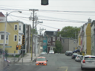
We ventured around the downtown of St. John’s which is really neat, and known for its bar-scene, which we didn’t partake in.
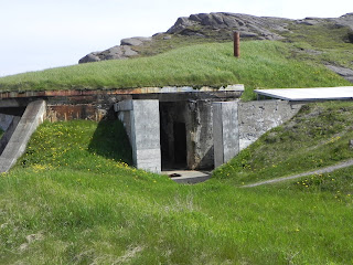
We also went to Cape Spear. This is the site of the oldest lighthouse in Newfoundland. It is also situated on the most easterly point of North America. It is also home to a WWII gun battery.
St. John’s was great, but Gros Morne is definitely hard to top.
We loved our stay in Newfoundland. It has such an interesting landscape, history and culture. We spent two weeks there and we both feel as though there is still so much we could’ve seen and done. We are definitely going back and we’re definitely going to Labrador too.


